Services
Site Investigation & Mapping
The development and implementation of an effective and cost efficient site investigation and mapping program is the cornerstone of the geotechnical conditions and parameters at your site.
Surface and Subsurface Assessments, include:
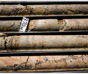
- Borehole drilling, coring, logging and sampling
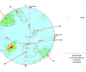
- Geological mapping
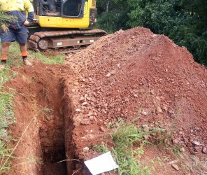
- Test pit logging and sampling
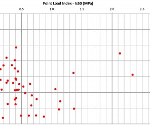
- Insitu testing
- Development of Geotechnical and groundwater models
- Aerial photo interpretation
You will find yourself working in a true partnership that results in an incredible experience, and an end product that is superior to the rest.
02
Our Projects
03
Get In Touch
You will find yourself working in a true partnership that results in an incredible experience, and an end product that is superior to the rest. Fill out the form below to discuss your next project.
